Is Google Maps Reliable in Venice? (+How Not to Get Lost in the Calli)
Visitors coming to Venice usually have a great deal of confidence in modern means of navigation. Most leave Venezia Santa Lucia Station, switch on Google Maps, and start to move according to the familiar blue dot into the maze of narrow alleys.
Pretty soon they can find themselves at what should be a turning-and end up facing a quiet canal instead of a path. This is when they realize that Venice does not work like other cities and needs an approach tailored to its geography.
This is a shared experience and tends to indicate not some flaw in technology, but rather something special about Venice itself. The medieval design of the lagoon city, its calli, scattered bridges, and closely built structures naturally create some challenges for universal mapping systems. While Google Maps is an excellent companion for general orientation, a Venice-specific tool-especially the VeniceXplorer Map proves far more effective when navigating the city's inner streets.
This article explains how the two tools can be used complementarily, why VeniceXplorer is especially valuable on foot, and how visitors can move confidently and efficiently around Venice.
Unmissable Venice Tours
Understanding the Geography and Address System of Venice
A Network of Islands, Canals, and Centuries-Old Paths
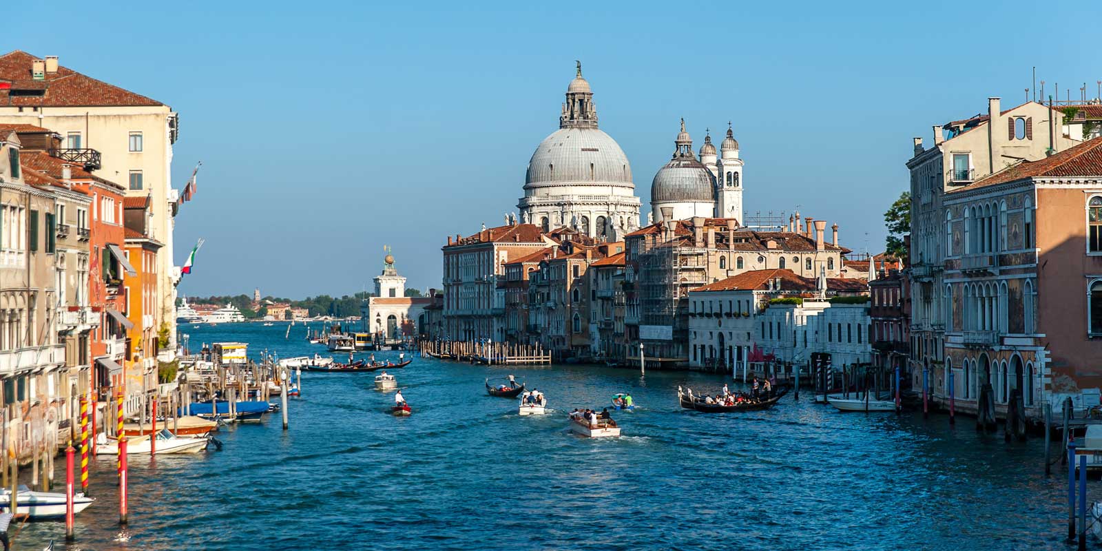
Venice is built upon over one hundred islands, each separated by different waterways and linked by an intricate structure of hundreds of bridges. This physical arrangement produces a pedestrian environment unlike any other city.
Many alleys narrow to less than a metre, widen unexpectedly into small campi, or end abruptly at a canal without a nearby crossing. Some streets pass under covered archways known as sottoporteghi, while others twist sharply around historic buildings that have stood unchanged for centuries.
The result is a maze of charming features expressing the medieval growth of the city. This same beauty introduces complexities to digital mapping systems that rely on uniform geometry.
Venice, without the grid as an organizing form, has no predictable street hierarchy; its spatial logic observes the rhythm of the Grand Canal, the surrounding Venetian Lagoon, and the historic relationship between islands. For this reason, the distinctive architecture, narrow calli, variable widths along canals, and unexpected turns of the city often create difficulties for universal navigation tools.
The Six Sestieri and Their Numbering
Administrative Venice is divided into six historical districts known as sestieri: San Marco, San Polo, Cannaregio, Santa Croce, Dorsoduro, and Castello. Each sestiere has its own characteristic shaped by centuries of cultural development, architectural style, and local tradition. But what complicates navigation the most is the historic numbering system in use throughout the city.
Buildings are numbered in sequence according to the order of construction, not according to their location on any particular street. Thus, one short stretch of calle might contain numbers ranging from 20 to 620 without any seeming logic.
A tourist might stand in front of a door numbered 2542, turn a corner, and discover that number 2543 is on the other side of the passageway entirely. This system predates modern addressing conventions and has been preserved as a part of Venice's architectural heritage.
Because mapping technologies rely on systematic numbering, this aberrant structure means that digital tools have to decode layers of historical cartography, municipal records, and user submissions.
While Google Maps can easily pinpoint major landmarks like St Mark's Square, Doge's Palace, and the Bridge of Sighs, placing buildings precisely in the tighter calli tends to be more difficult. Maps specific to Venice, such as VeniceXplorer, tend to incorporate these historical patterns more organically.
How Google Maps Performs in Venice
Strengths: A Useful Orientation Tool
It has several key advantages for visitors looking to gain a sense of scale and orientation in Venice:
It gives travellers an idea of their general position in the city and its major districts which include San Marco Venice, San Polo Venice, and Cannaregio Venice.
It identifies famous landmarks such as St Mark's Basilica, the Rialto Bridge, Santa Lucia Station, and vaporetto hubs along the Grand Canal.
It gives estimated walking times to help visitors plan their journeys between popular sites.
It works particularly well across wider open spaces, such as Ponte di Rialto, the area around St Mark's Campanile, and the promenades lining the Grand Canal and Zattere.
For general navigation and situational awareness, Google Maps remains a reliable companion when travelers are positioned in open squares or major arteries that permit stronger GPS reception.
Natural Limitations in the Inner Calli
The dense architecture of Venice brings with it a natural limit of satellite navigation: Narrow alleys block the GPS signal, and reflective surfaces on the water may disturb positioning accuracy. Thus, the blue dot suddenly shifts, drifts, or rotates.
Sudden dead ends, the absence or presence of bridges, and temporary diversions-such as raised walkways during Acqua Alta in Venice-cannot always be interpreted instantaneously by global mapping systems. The peculiar numbering system means that finding particular addresses may require more Venice-tailored support.
Considering these factors, Google Maps tends to get travelers to the general area correctly but sometimes the last meters of walking, especially within smaller or historic alleys, require a Venice-specific mapping resource.
Why VeniceXplorer Map Is the Most Practical Map for Venice
VeniceXplorer is tailored to the geography, culture, and navigation patterns of Venice. Its data structure corresponds to the actual layout of the city and is therefore highly reliable in giving detailed walking directions.
What Makes VeniceXplorer Especially Effective
Purpose-Built for Venice’s Layout: It maps each calle, ponte, sottoportego, fondamenta, and canal with an accuracy specific to its locality so that no dead end or absent bridge surprises the visitor.
Clear Visualisation of Bridges: Bridges are rendered in crystal clarity so that travelers can grasp in an instant where crossings are possible; this is important for a city defined by waterways.
Detailed Vaporetto Information: VeniceXplorer contains real information about waterbus routes, stops, and walking approaches that complement other available tools like the Venice tourist map and Water Taxis services.
Updated with Local Knowledge: Since VeniceXplorer has as its sole mission the interpretation of Venice, changes in this city's physical environment-such as bridge maintenance, festival rerouting, or seasonal walkways-are represented more quickly than on global platforms.
Intuitive Interface for Visitors: Its structure precisely reflects Venice's authentic spatial organisation; this fact makes the translation into direct on-ground movement easier for visitors.
Most travelers with experience use a hybrid method: Google Maps for broad direction and VeniceXplorer for fine-detail navigation that correlates every turn with a real street, a real bridge, and a secure walking route.
Why Venice’s Medieval Street Logic Confuses Modern Navigation Tools
The structure of the city itself is the fullest expression of a pre-modern logic, grown out over centuries with little conscious application of the principles of city planning.
From modest fishing huts and trading settlements, it expanded into a dense network of islands linked at nearly every turn by bridges into a street pattern that follows no predictable geometric order.
Many calli narrow suddenly to twist around private courtyards, slope into sottoporteghi, or end in canals without warning; others widen into irregularly shaped squares or bend in unexpected directions that defy any presuppositions of a grid.
The medieval pattern complicates the work of global navigation systems that rely on systematic street hierarchies with continuous routing lines. The GPS signals often rebound from stone walls, water surfaces, and closely packed architecture, making the digital position markers drift or rotate.
A route that appears quite straightforward in a digital map may well be, in actuality, a passage with sharp angles, narrow passageways, or the absence of a bridge where one might expect a continuation.
A map designed specifically for Venice, then, is more legible. The VeniceXplorer Map interprets the medieval geography of the city with a great level of accuracy, marking each calle, sottoportego, courtyard passage, and bridge in such a way that reflects the lived reality of the city.
Further, with its navigation functions, one will find detailed articles, themed itineraries, and practical guides in VeniceXplorer, all specially written for visitors. Such a combination makes it the most reliable tool for understanding the logic of Venice's oldest streets, where global mapping conventions cannot outperform local insight.
How Local Signage Outperforms Digital Directions in Key Areas
The yellow directional signs are among the most reliable navigation systems in Venice, placed at major intersections throughout all six sestieri. These signs give directions to the key destinations in the city, including San Marco, Rialto, Ferrovia, and Piazzale Roma. They exist precisely because Venice's street network cannot be assumed to follow any standard rules of continuity or street order. Unlike the digital tools that have to interpret satellite data and historical numbering inconsistencies, these signs reflect confirmed, physically walkable paths.
That is where their strengths really come into play: in narrower calli where the satellite reception is weak and the blue dot can become unstable.
The yellow signs help travelers navigate around detours, through underpasses, across bridges, and onto routes locals have been using for generations. During peak tourist seasons, construction diversions, or festival-related closures, these remain reliable markers of the right direction.
The VeniceXplorer Map is, in this respect, an excellent counterpart: while the directions have been graphically communicated to identify paths that local signage refers to, its maps incorporate the position of sestiere boundaries, bridge locations, and patterns of pedestrian movement in a way that represents very accurately the way locals actually find their way around.
Working in tandem, the physical signage accuracy and intuitive underpinning of VeniceXplorer's traveler-specific map mean that visitors can achieve a degree of precision far greater than would be possible by relying on general-purpose apps alone.
Best Venice Passes
When to Trust Your Instincts Over Any App—Digital or Otherwise
Not even the best of mapping tools can prepare you for intuitive decision-making along the way, such as an unexpected canal, construction barriers, festival rerouting, acqua alta walkways, or alleys too narrow for a stroller or luggage.
Digital navigation at that moment, whether Google Maps or anything else, can't immediately adjust for such temporary changes.
Travelers are well served by knowing when to stop, look around, and trust situational awareness. Dead ends, missing bridges, and improvised routes created during acqua alta often create conditions where it's necessary to deviate from the recommended path.
Sometimes, turning back or following the flow of other pedestrians, or looking at nearby signage, will yield the best solution.
This is where VeniceXplorer Map excels: its structure encourages visitors to understand Venice's geography, not just follow a route from turn to turn. In detailed, well-written articles and step-by-step walking suggestions, in carefully crafted itineraries, and explanations on how the pathways of the city shift during seasonal conditions, VeniceXplorer equips travelers with knowledge that will help make smart real-time adjustments.
After all, Venice rewards the navigator of its thoroughfares with a combination of tools and awareness: Google Maps for general orientation, VeniceXplorer for local precision, and one's own intuition to make sense of the unexpected. In this way, even the most tangled reaches of the labyrinth become accessible-and a pleasure to explore.
Visitor Information & Ticket Information
Visitor Information
Opening Hours: The standard hours of visiting for most of Venice's major attractions start off at around 9 am and proceed well into the early evening. For example, one full-day itinerary published by professional guides advises starting at 9:00 a.m.
For further details or to confirm the opening hours, visitors are requested to consult each site in advance, especially during the off-season, public holidays, or special events.
Best Time to Visit: The best time to start the visit is early in the morning when the town is much quieter, with a good deal fewer people, above all on the narrower calli and smaller bridges. Guides suggest starting around 9 am because of lighter foot traffic.
Another good window is in the late afternoon, which is when many day-trips leave and crowds are thinner at that time. If possible, travelers should avoid peak cruise-ship arrival times and use hours that are off-peak for easier travel.
Dress Code and Entry Rules: Venice is a casual city, but visitors to major religious sites such as the basilicas are expected to dress modestly: shoulders covered, no super-short skirts or shorts. Some sights may ask that you dress respectfully and cover up for temple-like interiors.
Regarding entry rules, the guests should take notice: some inner paths and bridges may be closed; such situations cannot be signaled by digital navigation tools alone.
Visitors are also requested to carry some kind of valid ID or passport on them, to check security-screening policies at major palaces and basilicas, and to allow a modest amount of time for bag-checks.
Ticket Information
Admission prices for Venice's most important monuments vary, often offering "skip-the-line" access, while some of them require reservations in advance. Guides strongly advise early booking to avoid possible long queues, especially during peak seasons.
Many attractions operate with timed-entry procedures, and turning up outside your designated slot can result in delays or even the need to rebook. Large combined tickets or city passes can add value by allowing multiple stops for visitors, including several sites and different transport links.
Online Booking: Online booking is suggested for the most efficient experience. "Skip-the-line entry recommended on big sights", one guide from Venice recommends; booking in advance cuts out confusion and queueing.
When visitors book online, they should: Check for an exact date, time slot, and the validity period. Check policies on cancellations or changes. Check if the ticket covers any special exhibits or terraces. Check if transport passes, vaporetto, or multi-site entries are included..
Guided Tours: Local guided tours are quite useful in Venice, considering its complicated layout and the great relevance of the local context. As one of the guides says, while tools like Google Maps would provide general guidance, it would be very important to have a local guide or a map that covers Venice.
Guided tours are indeed very varied in their themes-from major site visits, such as basilica and palace, to off-the-beaten-path walks through hidden alleys; from food and artisan tours to lagoon-island excursions.
Note for Visitors: Small-group or private tours for a more personalised experience. Tours which include skip-the-line access or early-morning slots. Whether the tour language and atmosphere fit their travel style.
Our Recommended Tickets
St. Mark’s Basilica Visit with Classic Gondola Ride
Tour of St. Mark's Basilica & Doge's Palace with Entry
Venetian Elegance: Lagoon Cruise with Live Classical Music
When selecting tickets, visitors should prioritise flexibility, time-slot confirmation, and alignment with their chosen itinerary—keeping in mind that Venice’s physical layout and local conditions (bridge closures, acqua alta) may require adaptive routing.
How to Navigate Venice Confidently
Pre-Arrival Preparation
Download Google Maps and VeniceXplorer and use them offline.
Save hotel addresses, vaporetto stops, and major reference points including Piazza San Marco, Rialto, and Ferrovia.
Study the basic layout of the Venetian Lagoon and the six sestieri.
On-Site Navigation
Use Google Maps for broad positioning and general direction.
Use VeniceXplorer to check street-level turns, bridges and canal crossings.
Follow the yellow directional signs in Venice-- they correspond reliably to major hubs such as San Marco, Rialto, and Ferrovia.
Stop and reassess when an app leads you to a canal for which you cannot see a bridge.
Backup Strategies
Bring along a simple paper map from a tourist office for reassurance.
Ask shopkeepers, vaporetto personnel, or locals when you're unsure—Venetians are used to directing lost visitors.
Best Venice Entry Tickets
Conclusion
While helpful, Google Maps is best utilized in Venice for much more general purposes than anything else. For the specific job of accurate navigation, a map built for the unique environment that is Venice is necessary.
VeniceXplorer Map doesn't replace Google Maps but brings clarity to the narrow calli, precise bridge identification, and reliable visualization of the actual walking network in Venice. Used in combination with the strengths of both tools, plus signage and simple situational awareness, a visitor should be able to navigate around Venice with ease and avoid many common frustrations of the labyrinth.